
Hiking in Armenia: Mountain Trails and Local Travel Experiences
8 min read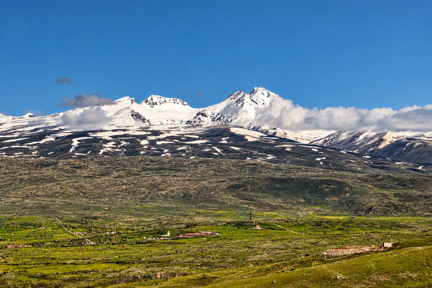
A forest path leading to a medieval monastery. A volcanic crater holding a mountain lake. A village where a long walk ends with a home-cooked meal and conversation.
Hiking in Armenia brings landscapes and people together. For travelers seeking local travel experiences, its trails offer a way to discover both the mountains and the communities living among them.
That combination has earned international recognition. National Geographic included the Transcaucasian Trail in Armenia in its Best of the World 2027 selection of 25 destinations, highlighting the country’s mountainous landscapes, historic paths, and rural communities.
Plan a Hike with the Transcaucasian Trail and HIKEArmenia
Armenia offers everything from woodland day walks to demanding mountain crossings. Two initiatives have helped make these landscapes more accessible to hikers.
The Transcaucasian Trail: Discover Armenia on Foot
The Transcaucasian Trail, or TCT, is a developing long-distance trail network across the Caucasus. Its Armenian route extends for more than 800 kilometers, connecting forests, volcanic highlands, canyons, and villages.
Travelers do not need to complete the entire route. A shorter section can introduce a single region, leaving time for monasteries, village stops, and conversations along the way.
Some stretches require independent navigation and self-sufficiency. Updated route information matters, as trail alignments and conditions can change.
HIKEArmenia: Choose a Route That Fits
HIKEArmenia helps travelers compare trails by distance and difficulty, explore route descriptions, and find local hiking expertise.
It is particularly useful for planning several day hikes rather than one long expedition. A trip might combine a fortress walk in Vayots Dzor, a forest trail in Dilijan, and a mountain ascent later in the week.
Both initiatives are featured in the Armenian Tourism Committee’s hiking guide.
Vayots Dzor: Rocky Mountains, Fortresses, and Wine Country
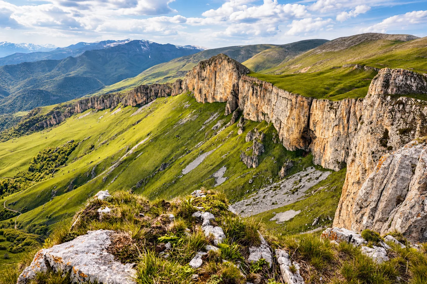
Vayots Dzor offers exposed ridges, deep valleys, and mountains colored in earthy reds and browns. Its trails connect dramatic scenery with medieval monuments and villages shaped by Armenia’s winemaking traditions.
Hike to Smbataberd and Tsaghats Kar
The villages of Artabuynq and Yeghegis provide access to Smbataberd Fortress. Its walls occupy a commanding position above the valleys, making the approach as memorable as the destination.
A longer outing can include Tsaghats Kar Monastery. Together, the sites create a walk through a landscape shaped by defense, faith, and village life.
The distance and climbing depend on the starting point and whether both monuments are included. Travelers should choose a specific mapped route before setting out.
Location and background: Smbataberd Fortress, near Artabuynq and Yeghegis
When to Hike in Vayots Dzor
Spring brings greener slopes and wildflowers, while autumn offers cooler walking conditions and harvest-season atmosphere.
Summer can be hot on exposed paths, so early starts and sufficient water are important. Higher routes retain snow longer than the valleys. Those planning a longer TCT journey should check the latest route alignment rather than rely on older regional maps.
Lori: Forested Gorges and Village Life
Lori reveals a greener side of Armenia. Forests cover the slopes, villages sit above deep gorges, and paths connect medieval ruins with communities where everyday life continues around them.
Explore the Dsegh Loop
Dsegh, the birthplace of poet Hovhannes Tumanyan, makes a rewarding base for walking. The village’s literary heritage adds another dimension to its surrounding forests and valleys.
The Dsegh Loop is approximately 8.7 kilometers, with an estimated walking time of four hours. The route passes through woodland and a river valley, with sights including the ruins of Bardzrakash St. Gregory Monastery and carved cross-stones.
The return climb deserves some energy in reserve. Wet ground or thick vegetation can make the walk slower than its distance suggests.
Location and background: Dsegh, Lori Province
Pair a Forest Walk with a Home-Cooked Meal
Late spring brings lush greenery, while autumn adds color to the wooded slopes. Summer offers shaded walking, although gorge routes can still feel warm and humid.
Lori is also a natural place to combine hiking with hospitality. LikeLocal features hosts in the Lori region who welcome travelers into their homes, making it possible to arrange lunch or dinner around a day outdoors.
The host’s location, meal time, and transport should be coordinated with the hike. Around the table, travelers can hear about village life, share their own stories, and discover the region through its food.
Explore LikeLocal’s hosts and meal experiences.
Dilijan: Forest Trails, Lakes, and Monasteries
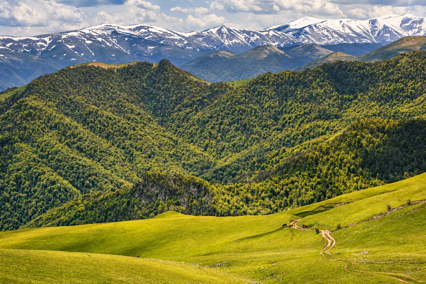
Dilijan’s appeal lies in its woodland landscapes. Trails move between shaded forest, open clearings, and villages where monastery domes appear above the trees.
It is a rewarding choice for travelers who enjoy combining nature with cultural stops.
Walk Between Parz Lake and Goshavank
The route between Parz Lake and Goshavank Monastery is approximately 7.2 kilometers one way. It connects a lakeside setting with forest paths, open sections, and the village of Gosh.
Because this is a point-to-point walk, hikers should arrange onward transport or allow enough time and energy for the return journey.
Longer routes also connect Dilijan town with the surrounding lakes and villages, creating options for a full day outdoors.
Location and background: Lake Parz and its surrounding trails
Experience Dilijan Through the Seasons
Late spring brings fresh leaves and green meadows. Summer provides woodland shade, while autumn transforms the forest into gold and copper.
Rain can make the trails muddy, and fallen leaves may conceal uneven ground. Winter offers a quieter landscape, but snow and ice require different equipment and preparation.
Azhdahak: A Volcanic Summit with a Crater Lake
Mount Azhdahak rises to approximately 3,597 meters in the Gegham Mountains. Its volcanic slopes and summit crater lake create a striking contrast with northern Armenia’s forests.
The wider range also contains prehistoric petroglyphs and dragon stones, connecting the mountain landscape with ancient human activity.
Choose a Summit Hike or a Longer Trek
An Azhdahak outing can take different forms. A day trip may combine a four-wheel-drive approach with a summit hike, while longer journeys involve camping and exploring more of the volcanic highlands.
Walking distance depends heavily on where the vehicle journey ends. Travelers should confirm the starting point, elevation gain, and return arrangements before choosing a route.
Location and background: Mount Azhdahak
Plan Around the Short Mountain Season
July and August are the core hiking months, with September sometimes suitable depending on conditions. Snow can linger into early summer, and the high terrain becomes wintry much sooner than Armenia’s lower valleys.
Even during summer, hikers need warm layers and preparation for sudden weather changes. The region’s remoteness makes experienced local guidance particularly useful. Explore the Gegham Mountains through Armenia’s official tourism website.
Aragats: Four Summits and a High-Mountain Challenge
Aragats is Armenia’s highest mountain, with four summits surrounding a vast volcanic crater. Its northern summit reaches approximately 4,090 meters, while the southern summit offers a more accessible—but still demanding—mountain hike.
Start from Lake Kari for the Southern Summit
A common approach begins at Lake Kari, around 3,200 meters above sea level. From there, hikers climb toward the southern summit, approximately 3,890 meters high.
A typical return route is around 10 kilometers, although the precise distance varies. Rocky ground, altitude, and exposure make this a substantial outing even for travelers comfortable with lower-elevation walks.
The northern summit is a separate, more demanding objective and should not be treated as an easy addition to the day.
Location and background: Mount Aragats
Aim for Summer and Early Autumn
July through September generally offers the most practical hiking window. Earlier visits can encounter significant snow, while later autumn brings shorter days, colder conditions, and renewed snowfall.
Road access to Lake Kari also depends on conditions. Travelers should confirm access and mountain weather rather than judge the day by temperatures in Yerevan.
Choose the Right Season for Each Landscape
Armenia does not have one hiking season that suits every region equally.
| Location | General planning window | What makes the season distinctive |
|---|---|---|
| Vayots Dzor’s lower and middle slopes | Spring and autumn | Green spring hills, harvest atmosphere, and cooler walking conditions |
| Lori | Late spring to autumn | Lush woodland, shaded sections, and autumn colors |
| Dilijan | Late spring to autumn | Forest walks, fresh spring growth, and colorful autumn foliage |
| Azhdahak | Mainly July–August; September if conditions permit | A short season for exploring high volcanic terrain |
| Aragats summit hikes | Generally July–September | Alpine landscapes, with snow and weather affecting access |
These are planning windows rather than guarantees. Elevation, recent weather, and the chosen route all matter.
Prepare for the Actual Trail
Destination pages help identify places, but they do not replace a hiking map. Travelers should download their chosen route, check recent conditions, and arrange return transport before setting out.
Suitable footwear, layers, water, food, and offline navigation are important. High-altitude routes require particular care, and unfamiliar mountain terrain is a good reason to seek experienced local guidance.
Make Room for the People Along the Trail
A hike reveals Armenia’s landscapes. Time with local people adds another perspective: how the seasons shape daily life, what grows nearby, and which dishes arrive on the family table.
In Lori, travelers can pair their walking plans with a lunch or dinner arranged through LikeLocal. For other regions, they can ask the team about suitable host options before adding a meal to the itinerary.
These local travel experiences give a hiking trip room for more than distance and summits: a warm welcome, good food, and stories shared after a day outdoors.